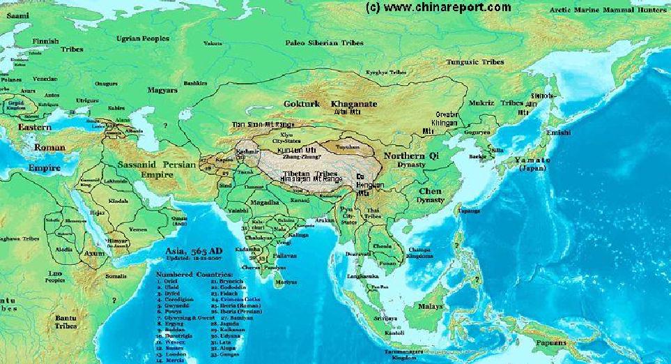
This Satellite Image based Map gives an overview of Asia Entire, depicting the Nations, Kingdoms and Tribal Regions in the Year 565 AD. Much can be said about the various Nations and Tribes within these vast Regions.
Introduction to Map of Asian Nations & Territories in 565AD - 01A
ChinaReport.comat
The China Report
Marks location of Monument or Cultural Historic Site
Marks National or International Airport
Marks City, Town or Village (Size)
Marks Mountain and Height in Meters
Sea of Japan
Browse the Satellite Image Based Map of Jilin Province, Lioning Province, North-Korea and South Korea, and Click through to More Backgrounds & Fotos of Places Reported on by www.ChinaReport.com
In Korea and South Manchuria the Goguryeo Kingdom has blossomed. The Tribes of Northern Manchuria and Inner-Mongolia have split between the Mulkriz Tribes, and the Gokturk Khanate in which Mongolians and Khitans are United.
As for the situation in China, The Nation is split between the Northern Qi and the Chen Dynasty. The Qi Dynasty controls the Hexi Corridor (currently part of Gansu Province) as far as Dunhuang, however further access to the trading pathways of Central Asia first established under the Han Dynasty (206 BC - 220 AD) have been temporarily closed due to the emergence of the XiYe City State in the Taklamakan Desert and Tarim River Basin as well as the unification of warring Mongol tribes in the Gokturk Khanate, both powerful adversaries.
Tibet has been unified in the Zhang Zhung Culture, who by now are considered the original culture of the Bon religion, Tibets oldest traditional faith and culture. Although a patchwork of Tribes, early Kingdoms have arisen in the Yarlung Valley (1st Century AD) and other Regions of the Tibetan-Qinghai Plateaux.
Yunnan is not part of the Chinese Empire and the free home of Thai Tribes with Cultures much similar to those of South-East Asia.
Asia Report
Russia
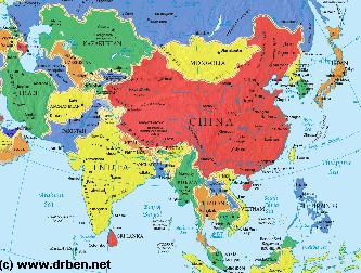
Asia Report - Map of Asia Entire . All Countries, Borders & Capitals
Full Geographical Overview Map of Asia Entire with Zoom & Scroll Functions, Relief Feautures, Oceans, Main Rivers and Capital Cities.
This Map of Asia includes all Asian Countries with Names and Borders, Disputed Border Regions in Asia, Capital Cities of all Asian Countries and Main Rivers and Mountain Ranges.
Manchurian
Plain
CheJu Straight
Oki Islands (Japan)
Yellow
Sea
South
China
Sea
The Territories of India, Pakistan, Kashmir and Afghanistan are split into a multitude of tribal nations many of whom can be traced today. The Arabian Peninsula knows 7 Civilizations and parts of the Sassanid Persian Empire. Neigboring North-Western Africa harbors various early Nations and the Egyptian Territories of the (declining) Western Roman Empire. Northern- and Central Europe are only counted as filled with various Forest Tribes.