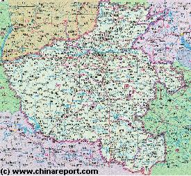
The Topography of Henan Province can general be seen as follows - full introduction to Henan available soon !!
Introduction to Henan Province (河南省) of China
Nanzhang
Shennongjia
Fangxian
Laohekou
Shiyan
Danfeng
Shangnan
Lu'An
Linzhou
Hebi
CaoXian
Guting
Fenqui
Taiqian
Fanqian
Puyang
Yongji
Yixian
Qinshui
Hejin
Jincheng
Linfen
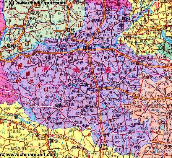
Gongyi
Ruicheng
Jiaozuo
Luoshan
Nanzhao
Yuncheng
Guangshi'
Taikang
Xincai
Huangchuan
Suizhou
Woyang
Heshan
Xuanhua
Lingbao
Songxian
Sanmenxia
Luoyang
Kaifeng
Anyang
Jining
Dengzhou
Baofeng
Zhoukou
Xiangfan
Nanyang
Leihe'
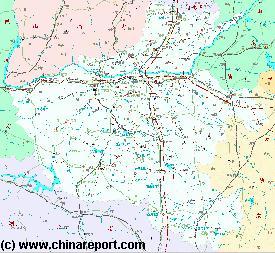
Xuchang
Heze
Xinxiang
Zhengzhou
Sanmenxia Reservoir
Danjiangkou Reservoir
ChinaReport.comat
Henan Province of China
South
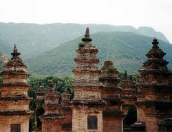
Highlights, Monuments and Scenic sites of Henan Province
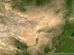
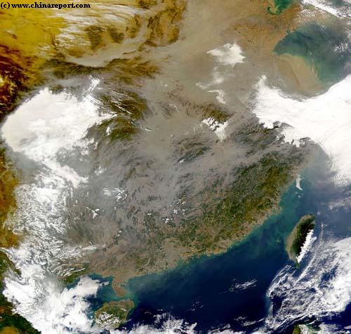
Map of the Gobi Desert & Yellow River Flow
Satellite Image Map of the Gobi Desert Region. Map overviews North-West Xinjiang Autonomous Region, Mongolia, Inner Mongolia and North and North-Eastern China giving a Full Overview of the Gobi Deserts and Yellow River Basin. Map includes country borders, name + location of Cities and Villages (clearly visible).
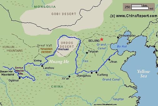
A Full Schematic Map of the entire flow path of the Yellow River. Map overviews Qinghai Province, Parts of Sichuan Province, Gansu Province, Ningxia Hui Autonomous Region, parts of the Republic of Mongolia, Inner Mongolia Autonomous Region, Shaanxi Province, Shanxi Province, Henan Province and finally Shandong Province, giving a Full Overview of the length of the Yellow River. Clearly visible details of geographical features such as mountain ranges, rivers, valleys and lakes. The Map includes main cities along the River, popular and famous scenic spots, the dams and water reservoirs on the Huang He and other relevant informations.
There is no information available on the landmarks, monuments and hot-spots of Henan province at this Time.
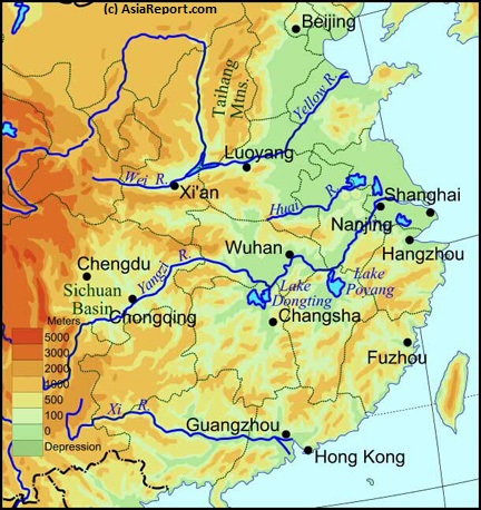
There is no information available on the main rivers and waterways of Henan Province, at this Time.