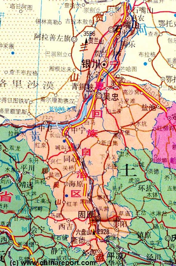
Going round the Map in clockwise motion neighboring provinces of NingXia are Inner Mongolia AR to the North-West, North, and North-East, Shaanxi Province to the East, and Gansu Province in the South-East, South and South-West.
The Capital city of of lightly populated Ningxia, Yinchuan, can be found in the Northern parts of the Province, situated on the west bank of the Yellow River (Huang He) and at some distance due East of Helan Shan mountain-range (+/- 3500 meters) which protects it from the Dust, winds and Sand blown in from the TengGer, a sandy and dry part of the Gobi Desert of Inner Mongolia and NingXia.
Introduction to NingXia Hui Autonomous Region of China Map 1A - Geographic Map
South of Yinchuan lies the huge Yellow River water reservoir of XingTongXia, where a magnificent green belt grows in between of dry and harsh lands. Atop mountains along the Western edge of the Reservoir another remote section of the Great Wall of China can be found, marking the border of Old Ming DynastyChina and Western Ningxia Hui Autonomous Region. The South is claimed by rough mountains such as XuanHua Shan and Xumi Shan (Treasure Mountain), making up the LuiPan Range. In this mountainous southern part of the Province, the Valley of the Qingshui River, a railroad and recently a highway lead South to pass an Inner Section of the Great Wall of China at GuYuan before meeting KongTong Shan in the far South, which forms the border with Gansu Province. From here it is +/- 130 kilometers to BaoJi in Shaanxi Province, the next main City Train Station.
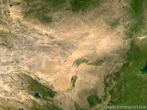
Satellite Image Overview of China, The Gobi Desert and flow of the Yellow River with NingXia Province clearly visible.